
Portfolio
4th Place Solution for SpaceNet-7 Challenge
Won the 4th place (top 1.3 % amoung 300+ teams) in SpaceNet-7 which was featured as a competition at NeurIPS’20 conference. In SpaceNet-7 competition, participants were asked to identify and track buildings in satellite imagery time series collected over rapidly urbanizing areas.
I have developed a pipeline that combined deep learning-based instance segmentation and a simple yet effective rule-based multi-object tracking method.
See winners announcement for details.
Further details comming soon.


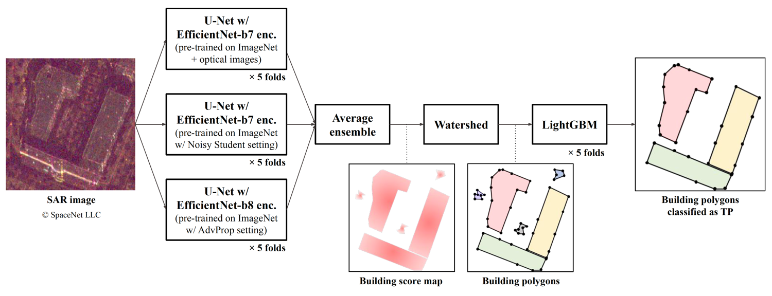
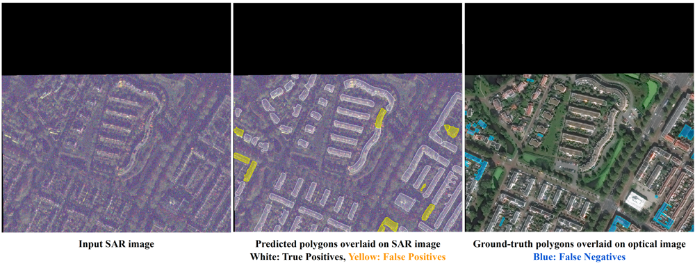
4th Place Solution for SpaceNet-6 Challenge
Won the 4th place (top 1% amoung 400+ teams) in SpaceNet-6 competition which was held as a part of CVPR’20 EarthVision workshop. In SpaceNet-6 competition, participants were asked to extract building footprints from SAR (Synthetic Aperature Radar) remote sensing imageries.
I have developed an effective pipeline combining deep learning-based instance segmentation and post-filtering using LightGBM.
See winners announcement, slides, video, and GitHub repository for details.
Gaussian YOLOv3 in PyTorch
Implemented “Gaussian YOLOv3: An Accurate and Fast Object Detector Using Localization Uncertainty for Autonomous Driving” [Choi+, ICCV’19] in PyTorch and reproduced the performance of the original Darknet implementation.
See GitHub repository for details.
Car Counting in Aerial Images
Developed a convolutional neural network to count cars in aerial images.
See GitHub repository and blog post (in Japanese) for details.
